Navigating a channel using red & green buoys
Before we get into details, it is worth noting that the colours, shapes, and lights of channel markers change depending on the buoyage region. There are 2 buoyage systems worldwide - Region A and Region B. Region B is the Americas, Caribbean, Philippines, and Japan. Region A is every other country.
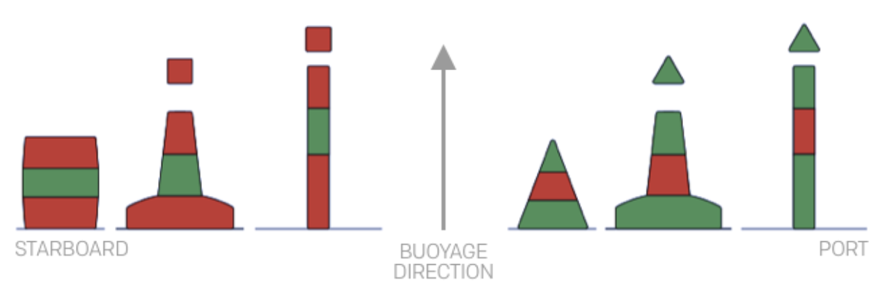
In region A, red buoys are on the port (left) side, green on the starboard (right) side travelling in the conventional direction of buoyage (generally from sea towards a harbour or upstream). The system in region B works in reverse, so that red buoys are on the starboard (right) side, green on the port (left) side travelling in the conventional direction of buoyage. The picture on the left below shows Region A, and the picture below shows Region B. In both images, the conventional direction of buoyage is travelling from south to north. Throughout this post we will only be discussing Region A.
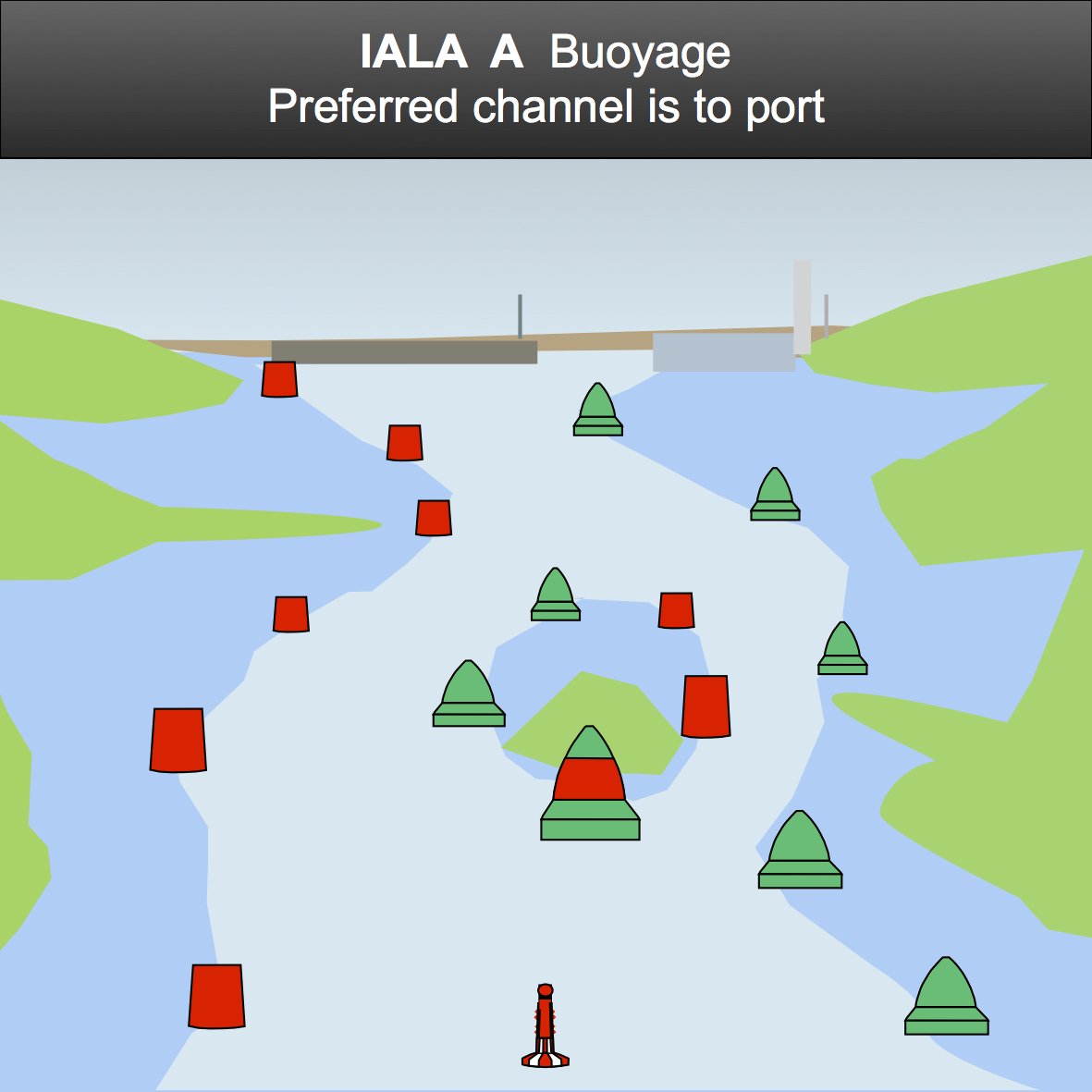
IALA A Buoyage System
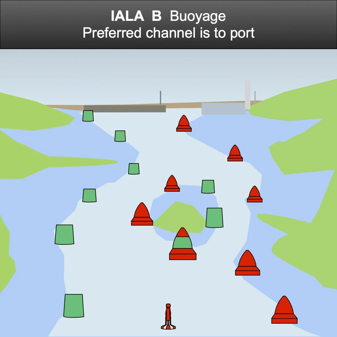
IALA B Buoyage System
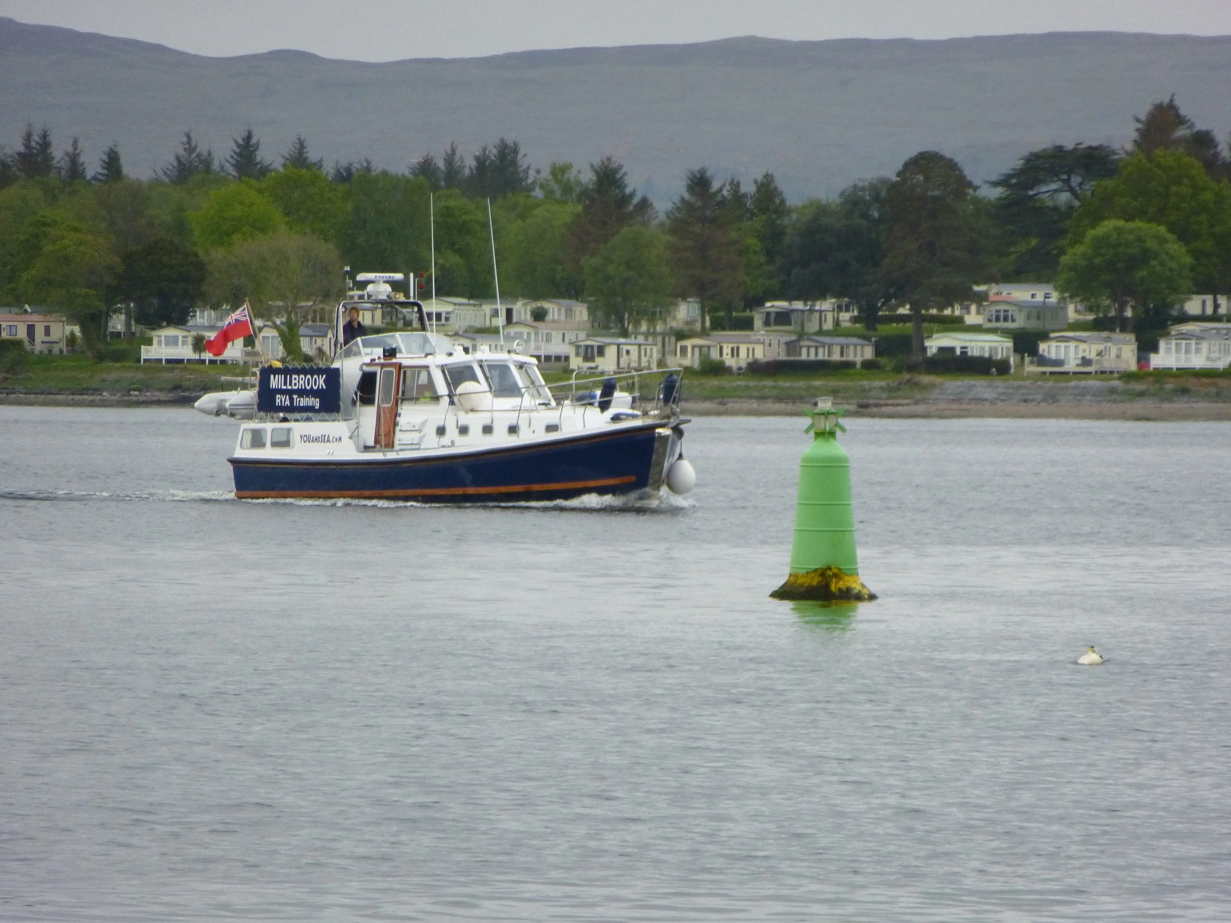
Navigating a Channel
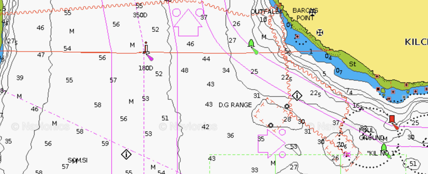
Direction of Buoyage as marked on a Navionics Chart
In many locations, channels are marked with pairings of Red & Green Channel makers; however, in a few locations, there is only a single Port or Starboard Marker. This makes knowing the location of the channel and deeper water slightly trickier.
A key chart symbol that is found on both paper and electronic charts is the ‘direction of buoyage’ arrow. On older charts, this will be an arrow with 2 magenta circles at the tip - see image. On newer charts, the 2 magenta circles will be coloured either red or green. It is important to note that the direction of buoyage symbol is showing the direction when entering a port, harbour or navigating up river - not departing.
Port Channel Markers:
Red, port = keep on your left going in
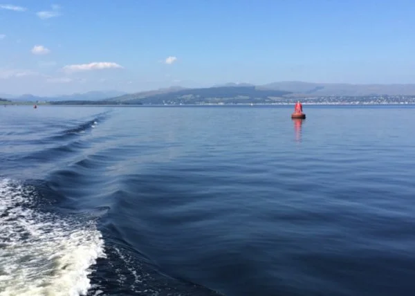
A port lateral navigation mark indicates the port (left) side of a navigable channel when travelling in the direction of buoyage. Port marks are coloured red and usually have a cylindrical “can” shape. If fitted with a light, the light is also red.
These marks guide a navigator by showing the safe side of the channel to keep to port. Port marks are often numbered with even numbers, which normally increase as you travel further into the channel. By identifying these marks and keeping them to the vessel’s port side when entering a harbour and channel, a boat can remain safely within the dredged or navigable water.
Green, starboard = keep on your right going in
Starboard Channel Markers:
A starboard lateral navigation mark indicates the starboard (right) side of a navigable channel when travelling in the direction of buoyage. Starboard marks are coloured green and typically have a conical shape or display a cone-shaped topmark pointing upward. If the mark carries a light, it will be green.
These marks guide navigators by showing the safe side of the channel that should be kept to the vessel’s starboard side. Starboard lateral marks are usually numbered with odd numbers, which increase as a vessel proceeds further into the channel. By identifying and keeping these marks to starboard when inbound, a navigator can remain safely within the marked navigable water.
Preferred Channel Markers:
A Preferred Channel to Starboard mark indicates that a navigable channel divides, and the main or preferred channel lies to the starboard side of the buoy. This buoy is primarily red with a broad green horizontal band and carries a cone-shaped topmark (pointing upward), the same shape as a normal starboard lateral mark. If the buoy is lit, it shows a composite group flashing red light sequence (2+1). To follow the preferred channel, a vessel should treat this buoy as a starboard marker and keep this buoy to its starboard side. If the navigator instead keeps it to port, they will enter the secondary channel.
A Preferred Channel to Port mark also indicates a point where a channel divides, but in this case, the main or preferred route lies to the port side of the buoy. The buoy is primarily green with a broad red horizontal band and normally has a cylindrical “can” shaped topmark, matching the port lateral mark shape. When fitted with a light, it displays the same composite group flashing (2+1) rhythm in the colour of the buoy. Navigators wishing to remain in the main channel should treat this buoy as a port marker and keep this buoy to their port side. Passing it to starboard would lead into the secondary channel. These marks are sometimes called bifurcation buoys because they indicate where a channel splits.
Top Tip: Look at the major colour of the buoy and its shape or top mark. If it is mostly red and has a can shaped top mark, it is a port mark and stays on the port side of the vessel.
Starboard and Port Preferred Channel Markers
It is critical to consult an up-to-date chart for the full details available because if you are navigating a small or shallow draft vessel, it could be perfectly safe to navigate up the secondary channel. Equally, to reach your marina or anchorage could require you to navigate up that channel.
Further blogs on buoys and buoyage to follow.