What is the MCA Small Ships Navigation & Radar Course?
About the Small Ships Navigation & Radar Course
The current (2023) version of the MCA Small Ships Navigation & Radar course is a revised version of the original Small Ships Navigation & Radar course, but reworked for Workboat Code 3.
The MCA Small Ships Navigation & Radar course is a Maritime and Coastguard Agency (MCA)-approved training package for people who navigate commercially operated small vessels under 24 m, especially when electronic chart systems (ECS) and/or radar are used. It is designed to make sure you can plan and navigate coastal waters, keep an effective bridge watch, and use radar safely for collision avoidance and navigation.
The SSNR course, as it is commonly abbreviated, consists of two individual courses, Radar and Meteorology (Day 1 & 2) and Electronic Chart Systems and Bridge Watchkeeping (Day 3-5).
What does the course consist of?
Days 1 & 2 - Radar & Meteorology
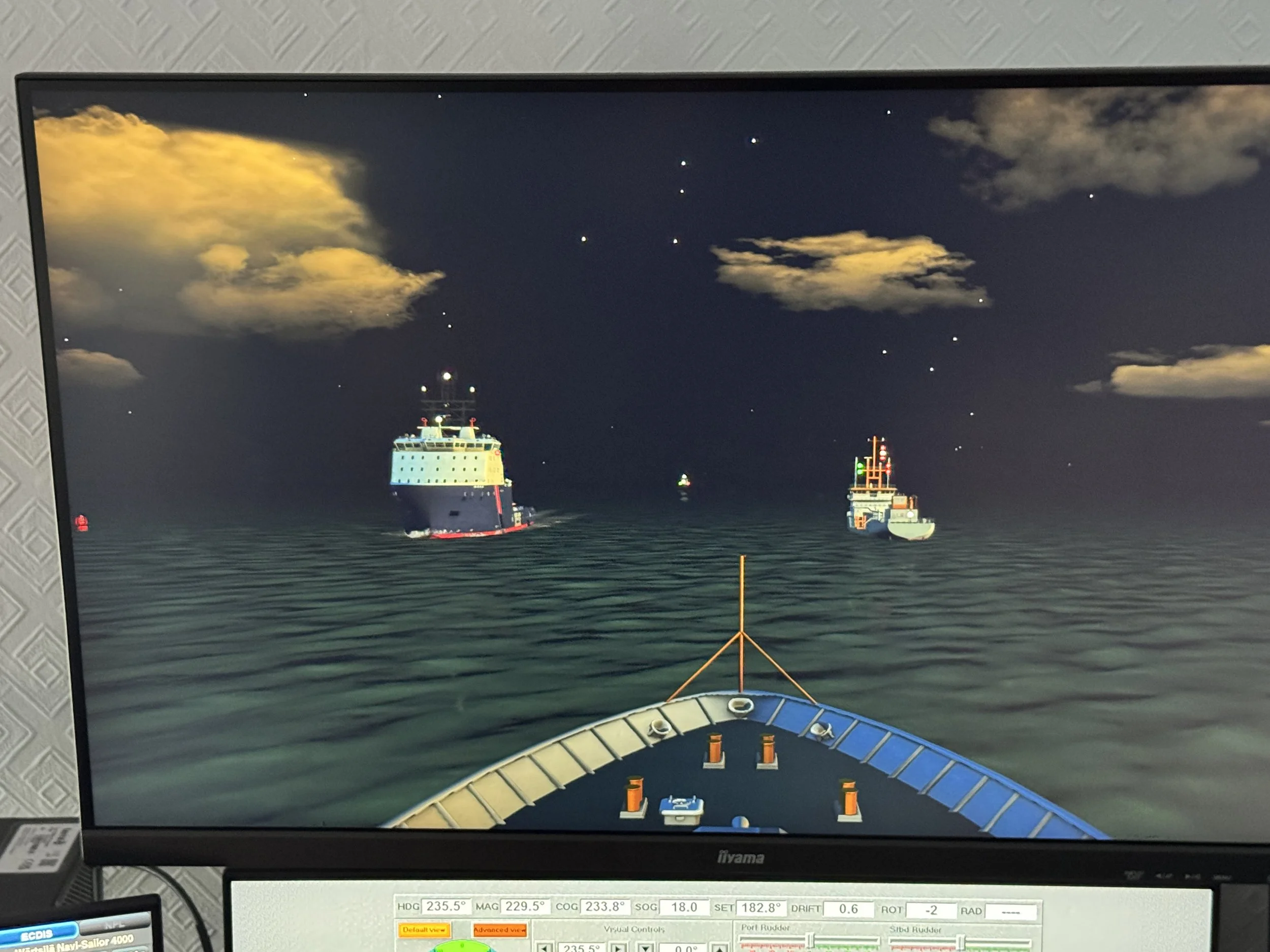
Our vessel on the approaches to the Port of Bahrain at night. Multiple ships, a narrow channel and a cross tide makes for a tricky passage in.
During days 1 & 2, you will learn about all things Radar with a lot of time spent on our simulator, concentrating on radar set-up and controls. The afternoon of day 1 is dedicated to the navigation skills of radar with emphasis on position verification, position fixing,
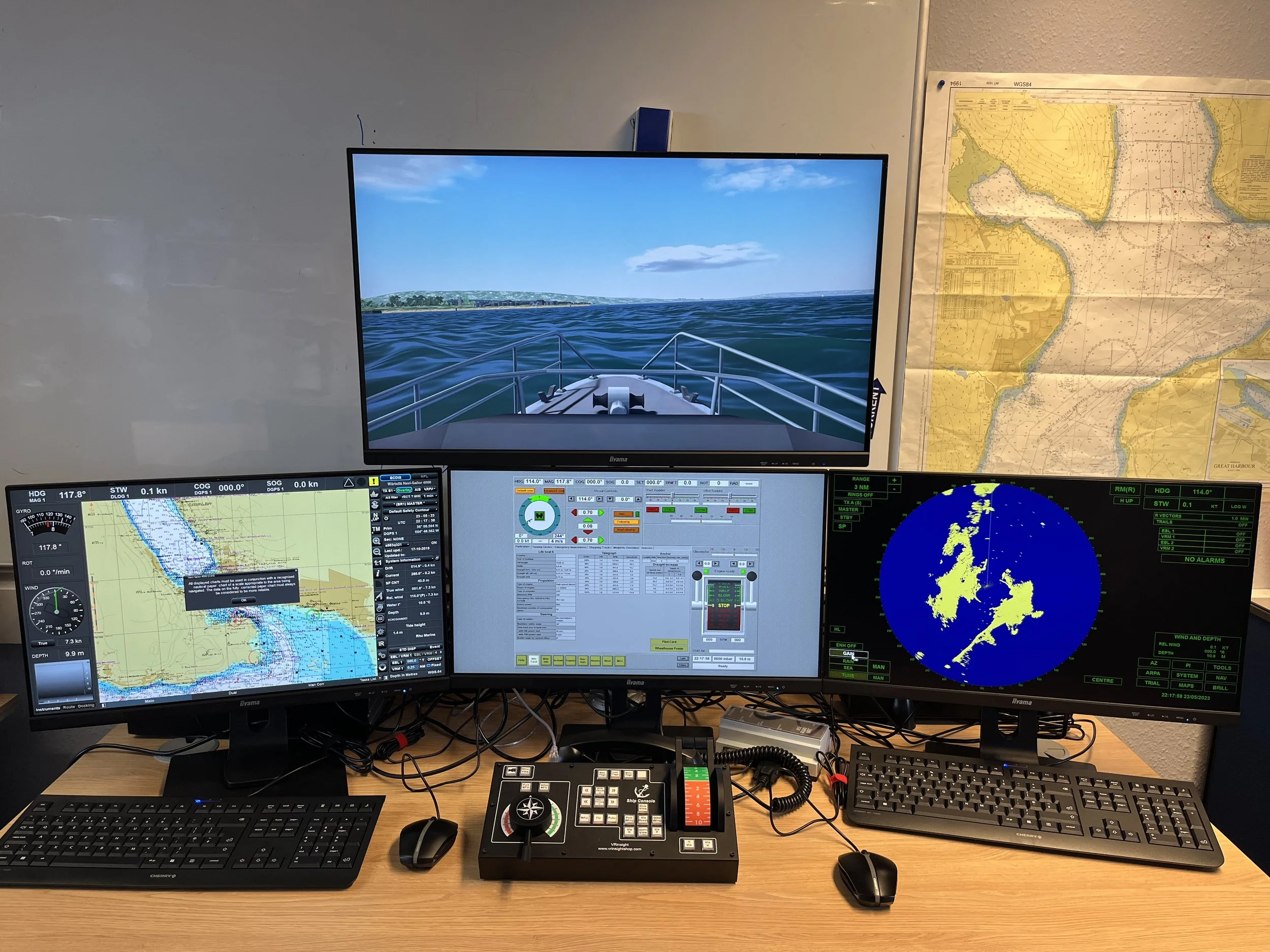
At You & Sea, we have invested a lot of time behind the scenes developing simulator scenarios that enhance and develop the knowledge of radar setup, the controls on the screen, and how radar is used for navigation and collision avoidance, with each scenario building on the previous. The objectives of Days 1 & 2 are;
To understand the types of Radar and the differences in use.
Using Radar as a ranging device.
Use and limitations of radar for bearing measurement.
Effect of horizontal bandwidth, particularly on land targets.
Use of Sea and ground stabilised modes of operation
Sea and rain clutter settings.
Relative and true motion displays.
True and relative trails and vectors.
Head-up (unstabilised) and North-up (stabilised) displays.
Shadow sectors, blind arcs, and false echoes
Plotting as an aid to collision avoidance.
Position fixing and radar navigation.
Use of parallel indexing techniques.
Days 3-5 - Electronic Chart Systems and Bridge Watchkeeping
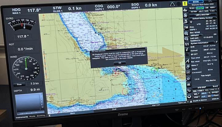
The ENC before a route is built.
Days 3 - 5 of the course are spent building on the newly developed radar knowledge, whilst designing and executing passages on our simulator. Day 3 looks at the background of Electronic Navigation charts (ENC’s), the setting up of the charts, the differences between raster and vector charts, waypoint use, and route building.
Restricted visibility is introduced on day 4, and the emphasis is on utilising Radar and ‘all available’ means to conduct two short passages. These two well-thought-out exercises on the simulators test the candidates' skills and knowledge in confined pilotage waters and, in the afternoon, crossing the English Channel. Before the afternoon exercise is run, the theory on Navigational Watch Handovers is discussed and put into practice.
The final day’s exercise brings together all the week’s learning with a tricky exercise on the South Coast. Multiple sensor failures, lots of traffic, tide, and restricted visibility are all encountered on passage. The short video below may give some impression..
Other topics included in Day 3 - 5 include;
Differences between vector, raster, official, and non-official charts.
Chart ordering and updating.
Data sources and category of zone confidence (CATZOC).
Symbology and interrogating chart features (pick reports).
Key types (approved/non-approved) and associated standards/regulations.
Required inputs and outputs, including sensor setup.
Orientation, zoom levels, base, standard, and custom displays, vectors/trails.
Overlays, to include ARPA and Automatic Identification Systems (AIS).
Safety depth/contour calculations.
Alarms and indications.
Man-overboard functions.
Methods of position fixing and application to electronic charting systems.
Monitoring global navigation satellite systems (GNSS) integrity, verification of position, and datums.
Suitable actions and alternative fixing methods in situations of GNSS denial.
Requirement for route planning, validation, editing & monitoring
A short clip of the exercise on Day 5 of the course.
Who needs to complete the course, or would benefit from it?
There are requirements to complete the course under both the Sport & Pleasure Code and Workboat Code 3. There are further considerations, such as the area of operation, the code, and what equipment is on the vessel.
Sport & Pleasure: Workboat Code 3
Radar -
Cat 6-2 - Strong Recommendation Cat 6 - 2 - Required
Cat 1 & 0 - Required* Cat 1 & 0 - Required
*Not required if a YM Offshore or Ocean CoC was completed before 15/12/25, can demonstrate Radar knowledge, or have previously completed a Radar course.
ECS:
ENC’s - Required Cat 6 - 2 - Required
ECS & Paper Charts - Recommendation Cat 1 & 0 - Required